Batch Print
Batch Print is used to print documents and reports for individual or multiple fields, including archived data. Most of the documents and reports in Batch Print can be obtained from other tools in the software. Batch Print allows a user to access every document and report from one tool.
The following section describes how to download and print reports.
1. Click Tools > Batch Print
2. Select a field.
Use the profile selector to navigate to a field. Users can identify which fields have a prescription or soil test by the Rx, SA, or SD icons next to the field ID’s.
Select the field or fields that you want to run reports on.
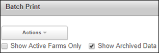
3. View Archived Data, if desired.
Click Show Archived Data.
Use the profile selector to navigate to a Grower and Farm. A list of archived years is shown below the Farm.
Click on a Season/Year to expand the folder and view a list of fields for the selected season. Users can identify which fields had a prescription or soil test by the Rx, SA, or SD icons next to the field ID’s.
Click on a field ID.
4. Choose which reports to download and print by dragging the desired report from the Available list to the Current list on the right, and clicking Print. The reports will download as a PDF to your computer. Multiple fields will take longer to generate than a single field.
5. The order that the reports are displayed in the Current list is the order that the reports will print.
Batch Print Report Descriptions:
Zone Map – Prints a large field/zone map.
Farm map – One page map of every field under a grower’s profile.
Farm Map (with Labels) – One page map of every field under a grower’s profile with labels.
EC-Shallow – Map of the EC Shallow layer that is collected with the Veris Cart or EM
EC-Deep – Map of the EC Deep layer that is collected with the Veris Cart or EM
Elevation – Map of the Elevation layer that was collected depending on the map type
Satellite Imagery (All) – Map of every satellite image that were cut in the Zoning process.
Satellite Imagery (Choose Date) – Map of selected Satellite images that were cut in the Zoning Process
Yield Goal Worksheet – One page worksheet to enter yield goals, crop choice (1st and 2nd year), fertilizer choices and fertilizer management plans.
Fertilizer Summary Report – ESTIMATED product average per zone by product and ESTIMATED totals and grand totals by zone and product.
Fertilizer Application Summary – Field totals by product and a map of the application file NOTE: totals are listed in both estimated lbs. and shapefile lbs.
Fertilizer Management Summary – One page field map of yield map, second year yield (if available), prescription map, and Zone map.
Map Maker – One page zone map with zones and acres.
Fertilizer Product Summary – Map of all products in the prescription with total lbs. and total acres (if prescription is smoothed the smoothed map is printed as well).
Seed Application Summary – Map of Seed Rx with a legend and seed bag totals by variety.
Seed Management Summary – Map of prescription, second year yield (if available), and Zone map.
Seed Product Summary – Table of zones with seeding rates and field average and field total along with prices.
Seed Multi-Hybrid – Map of each variety’s location on the map
Yield By Zone (All) – Table of each zone with both total, min, and average yield and moisture for all years of available yield data.
Yield By Zone (Choose) – Table of each zone with both total, min, and average yield and moisture for a selected year yield data.
Soil Sampling Map – Map of all the soil sampling points on the zone map with a background image.
Soil Analysis Map – Interpolated map of each nutrient tested when grid sampling.
Soil Sample Chart – Bar graph of each nutrient level in each zone.
Soil Type – Map with the SSURGO soil type with a background map.
Soil Sample Table – Map of the soil sampling mission with the Soil sample results by zone in a table.
Zone Soil Sample – One page report with zone map and the soil sample results below in a color-coded table that matches the soil sample tab in Prescription builder.
Reports Available in other Tools:
EC-Shallow – Available in Map Maker.
EC-Deep – Available in Map Maker.
Elevation – Available in Map Maker.
Satellite Imagery (All) – Prints every GNDVI image saved to a field. Available in Map Maker.
Satellite Imagery (Choose Date) – Choose which GNDVI image(s) to print. Available in Map Maker.
Yield Goal Worksheet – Available in Prescription Builder > Process tab.
Fertilizer Application Summary – Available in Application Manager >Fertilizer tab.
Fertilizer Management Summary – Available in Application Manager >Fertilizer tab.
Fertilizer Product Summary – Available in Application Manager >Fertilizer tab.
Seed Application Summary – Available in Application Manager >Seed tab.
Seed Management Summary – Available in Application Manager >Seed tab.
Seed Product Summary – Available in Application Manager >Seed tab.
Yield By Zone (All) – Prints every Yield By Zone Report. Available in Map Maker.
Yield By Zone (Choose) – Choose which Yield By Zone report to print. Available in Map Maker.
Soil Sampling Map – Available in Soil Sample Manager > Soil Missions Module.
Soil Sample Graph – Available in Soil Sample Manager > Soil Sample Grapher.
Map Maker – Prints the field/zone map report from Map Maker.
The following reports are only available from Batch Print:
Zone Map – Prints a large field/zone map. (Other zone map reports are available in Map Maker and Prescription Builder > Process tab)
Farm Map/With Labels – One page map of every field under a Grower’s profile, with or without Field ID labels.
Soil Analysis Map – Prints a nutrient map for every nutrient that was soil tested on a field. For Grid fields, this report is available in Soil Sample Manager > Soil Sample Grapher.